 I just finished reading Storms of my Grandchildren by James Hansen – it is basically an alarming presentation of evidence that not only is climate change affected by humans, but that the changes could indeed be dramatic and soon. While the author warns of effects more extreme than the ‘consensus’ of the IPCC, he argues very credibly. It is worthwhile to note that in achieving consensus, any group needs to ‘normalise’ opinion (i.e. compromise).
The IPCC cannot say “all is well”, as there is undeniable evidence that it isn’t, and they are, after all, a bunch of tree huggers (said with love!) .
However, it cannot say “ban all coal” either, because it would render itself at odds with governments, and find the party invitations will dry up sharpish. The IPCC said what it had to say from day one: there is a massive risk of disaster and we need to find a pragmatic way forward that does not punish any sector too harshly.
It also appreciates that it needs to gradually adjust the Zeitgeist. Each report will get more draconian, not just because the evidence is getting stronger, but because the audience is softening up with time. Of course, this public opinion inertia takes up time, which is exactly what we haven’t got.
James Hansen, is therefore now acting as a representative for those who feel the urgency is lacking. He accepts that his invitations to the Whitehouse may have got lost in the post of late, but he is gathering a following and starting to get heard.
Anyway, on to my point. While reading the book, I realized not only the lack of action against climate change, but also the lack of action to prepare for it. I read up on what various people are thinking (including the IPCC take), and I was wondering how much the individual can do.
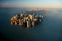
In a slump of morbidity (you read the book, you may have one too), I wondered how my town may look if sea levels does rise a few meters. It is not too hard to trace out the new shoreline, but it did make me think I could write a program that could plug into Google Earth in which you could dial in the sea level and take a look.
Initally I thought I might get lucky with new sea views to look forward to – then I realize my house would be completely unaccessible and my local town would be gone, along with my friends and also most of the roads…
Perhaps I should start saving for a nice big boat?
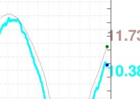
PS. Feed your obsessive-compulsive side – take a regular look here: http://arctic.atmos.uiuc.edu/cryosphere/ . Is this a good canary in the coal mine? I hope not! There is an alarming dip the last few days – (today is Dec 23, 2010) – tell me it was a blip! Did I mention looking at this daily will lead to the complete abandonment of statistical sense and every blip will be a crisis? I mention it now…
Google Earth has this capability, you have to use the “Sea Lvel Rise Animation” here (http://bit.ly/euJOo7) and make sure to enable it in GE. You can also find a narrated climate change “tour” with the plugin here (http://bit.ly/cyYA9s)
Thanks tekno! More or less exactly what I had in mind. Feel like an idiot now I didn’t even bother to check if it already existed!